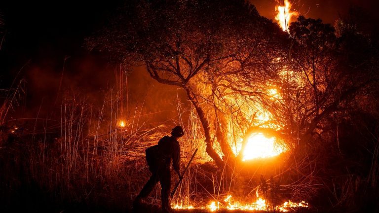
Epic events like Wildfires in Southern California do not have a single cause.
Although we do not yet know the official causes of the fires, we do know that the weather and climate conditions at the time they broke out provided an ideal storm for the rapid spread of the flames.
The first problem is that Los Angeles has been very dry. The city has only received 0.16 inches of rain since May 6, so the region’s rainy season is off to an unusually dry start. This created a lot of fuel for potential fires. But the lack of rain alone did not lead to the devastating fires we saw this week.
It was the wind that spread the fires so quickly once they started. An unusually strong mountain wind event, with northerly gusts of 80 to 100 miles per hour, spread the fires faster than anyone could stop them.
And we knew the weather was coming. Thirty-six hours before the fires broke out, the National Weather Service in Los Angeles warned of “destructive and potentially fatal windsextreme fire behavior and possibly the strongest northerly winds in Southern California since 2011.”
This December 1, 2011 event also brought powerful and destructive wind gusts to much of Southern California, including the Los Angeles metropolitan area.

Firefighters work from a deck as the Palisades Fire burns oceanfront property January 8, 2025, in Malibu, California.
Étienne Laurent/AP
Wind gusts of up to 97 mph were recorded in the mountains of northwest Los Angeles County, according to the National Weather Service. But unlike last week, no large-scale forest fires broke out like in 2011. More normal rainfall between October and December of that year might have avoided the same disaster.
Santa Ana events are typically associated with northeast to east-northeast winds in Los Angeles County and typically result in very little wind in the San Gabriel Valley and eastern LA areas. San Fernando Valley, home to many highly populated sections of the Los Angeles metropolitan area. .
The atmospheric configuration during this recent event oriented the winds in a more northerly to north-northeast direction. This sent the strong winds over the region’s San Gabriel Mountains in a trajectory that not only helped amplify their strength, but also made the air even drier as it rushed across side. This caused powerful wind gusts in areas that do not typically experience winds of such intensity.
What made this a devastating event in Santa Ana was that conditions higher in the atmosphere contributed to further increased surface winds.
In this case, an area of low pressure in the upper atmosphere was moving over Baja California. The cold, dense air associated with this system was positioned on a favorable north-northeast to northeast trajectory over the region. The particular configuration allowed colder air higher in the atmosphere to descend toward the surface and accentuate the already blowing winds. This sent powerful winds through the mountains of Los Angeles and Ventura County, crashing into the foothills and some coastal communities.
The direction of the wind and topography also played a major role. The San Gabriel Mountains and wind direction interacted to produce a damaging wind event that does not occur often. Mountains can also make winds more erratic because additional wind swirls, called wind vortices, can form as air passes over peaks and canyons.
So while the events of 2011 and 2025 brought powerful and destructive winds, a big difference is the current drought in the Los Angeles area.

A firefighter monitors the spread of the automobile fire in Oxnard, northwest of Los Angeles, January 13, 2025.
Étienne Laurent/AFP via Getty Images
Regarding climate changewe will not know the direct impact until climate attribution studies are completed. Although climate change has likely amplified some of the conditions that have contributed to the massive and destructive nature of wildfires, it is only part of a long list that also includes more direct human impacts like l rapid urbanization and land management.
But we know that wildfires in the West have become larger, more intense and more destructive and that human-amplified climate change is one of the main reasons.
And new research explains how climate change is making hydroclimate whiplashes more common. These are rapid alternations between extremely wet and dangerously dry weather.
As Daniel Swain, lead author of the research and climate scientist with UCLA explains: “This sequence of whiplash in California doubled the risk of wildfires: first, by dramatically increasing the growth of flammable grass and brush in the months before fire season, then by drying them out at exceptionally high levels with the extreme drought and heat that followed.”
Less than a year ago, Los Angeles experienced historic flooding and is now facing severe drought conditions. This literally adds fuel to the fire.
Finally, it is important to reiterate that California has been and always will be particularly vulnerable to wildfires simply because of its natural climate. The state historically experiences highly variable weather and climate conditions, typically varying from very dry to very wet periods.
Of the continental United States, California has the greatest annual variability between wet and dry conditions. As you move down into Southern California, this variability increases even more, according to Julie Kalansky, a climatologist and deputy director of operations at the Center for Western Weather and Water Extremes at the University of California, Scripps Institution of Oceanography in San Diego .
ABC News Chief Meteorologist and Chief Climate Correspondent Ginger Zee, ABC News Meteorologist Dan Peck, Matthew Glasser of the ABC News Climate Unit and ABC News Meteorologist Dan Manzo contributed to this report.


